Scotland 2008 – Ultralight Hiking or Hill Walking

Alison and I took our first trip together to Scotland in 2003. Since then we’ve been on many trips in the US and around the world but, we’ve always wanted to return to Scotland. This year we invited my father and his wife, Judith, to enjoy the best hill walking (hiking) in the world.
Photographs (except as noted) taken by Alan with an Olympus e520 digital SLR and Zuiko 14-42mm 1:3.5-5.6 lens.
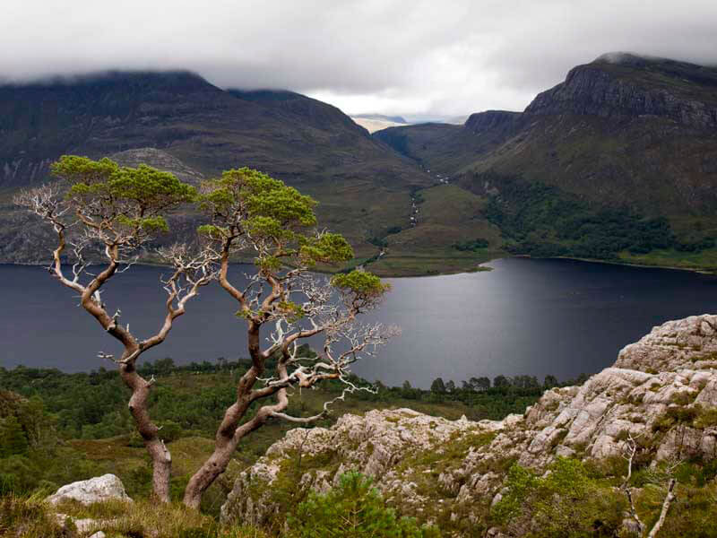
Scotland captured our hearts. Here a sudden opening in the clouds illuminates a lone tree and a small outcrop overlooking Loch
Marie in Wester Ross. The summit of Slioch (left) is still shrouded in mist at midday. Wester Ross was our favorite hill walking locale.
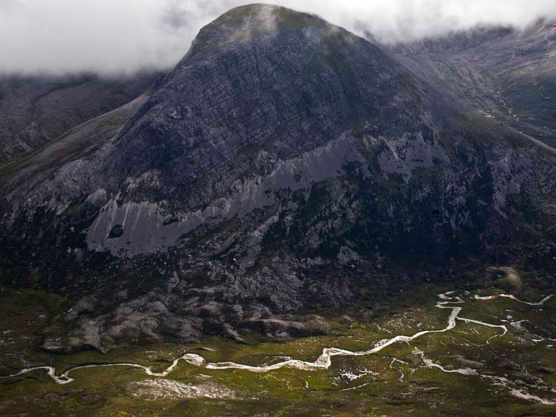
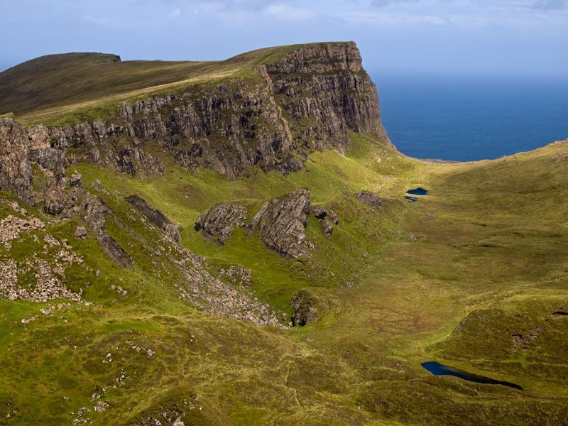
In the foreground is a small side ridge of Beinn Eigh. In the background and completely enveloped in clouds, is the main summit
ridge of Beinn Eigh.
Wester Ross
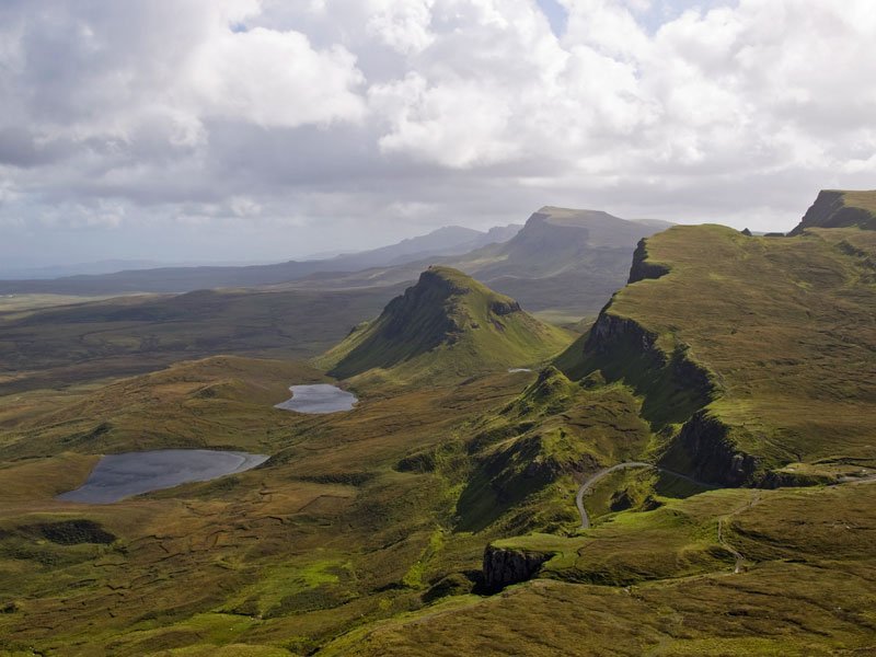
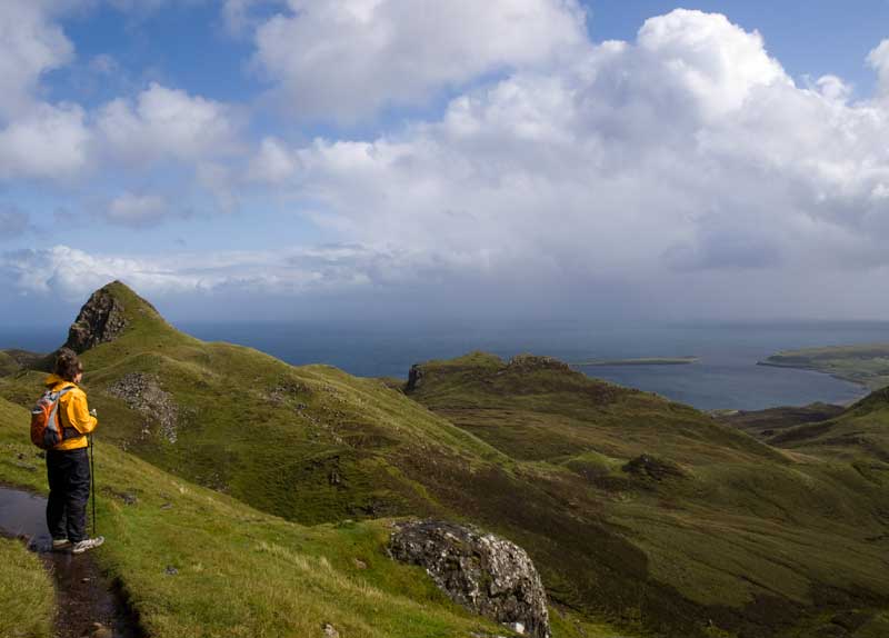
Isle of Skye: Looking down the vast landslip of the Trotternish Peninsula. The Storr 719 m (2385 ft), the highest point in
Trotternish is the furthest peak in the distance.
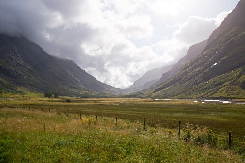
Glencoe
Buachaille Etive Mòr
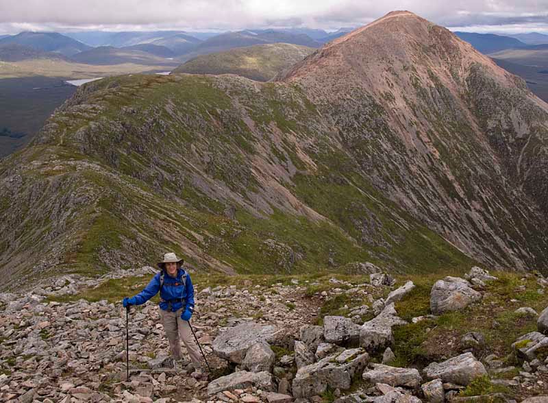
Alison summitting Stob na Doire of Buachaille Etive Mòr. The mountain is a five mile ridge with four distinct summits. Our loop walk
covered all four of the summits. The highest summit, Stob Dearg 1022 m (3352 ft), is reddish in the background.
Traversing the ridge towards Stob na Doire.
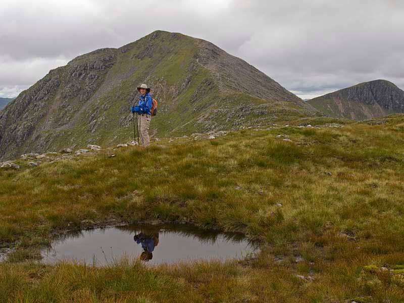
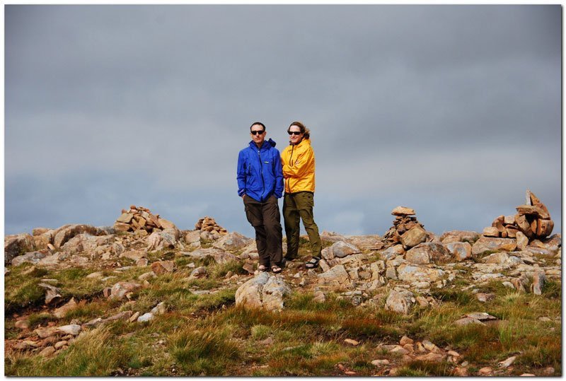
Together on the summit of Stob na Doire. Stob na Bròige in the extreme upper left is the other Munro summit of Buachaille Etive Mòr.
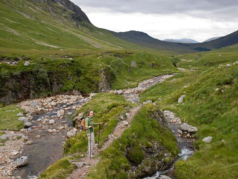
Hiking out along Lairig Gartain.
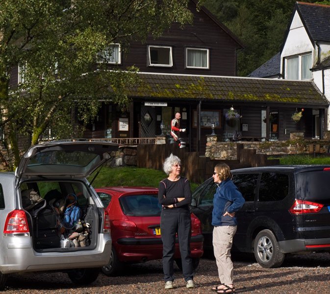
Judith and Alison ready to pop in for soup and dinner. The Clachaig Inn in Glencoe is a popular place for
hill walkers to warm up, dry out and re-fuel after a long day in the mountains.
It rained hard all night but in the morning the storm clouds cleared out of the Glen — a good sign for the day’s walk up the Lost Valley.
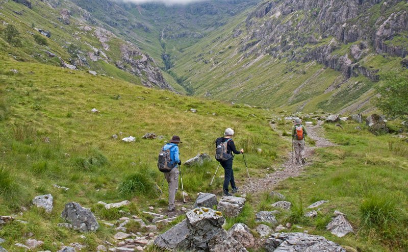
Richard, Judith and Alison, hiking along the terminal moraine just before dropping into the basin of the Lost Valley.
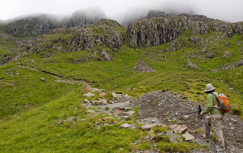
Richard and Judith stayed to enjoy the valley floor. Alison and Alan headed up to the mist covered ridge at the end of the valley.
Enjoying a quick lunch and a great view of the Lost Valley just before entering the mist.
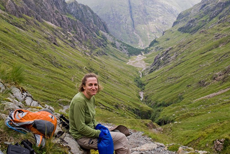
A parting shot of Glencoe. [Photo, Alison]
Isle of Skye
This August was the wettest on record for Scotland. The moderate rain and generally good hiking conditions in Glencoe were a blessing. For the rest of the trip in Skye and “Wester Ross” we had considerably more rain and mist. We averaged less than an hour of sunshine a day and had no more cloud free Munroes.
The Trip to Skye
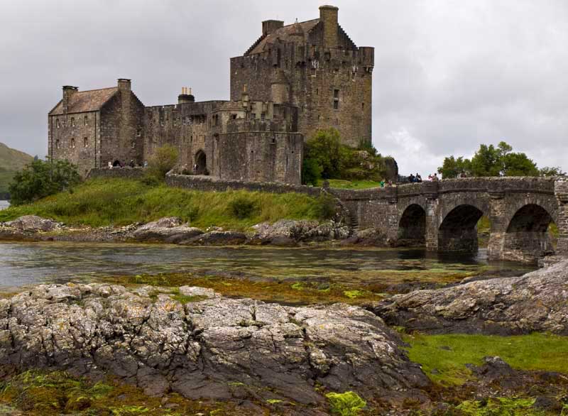
The requisite picture of Eilean Donan Castle. It is the most photographed castle in Scotland.
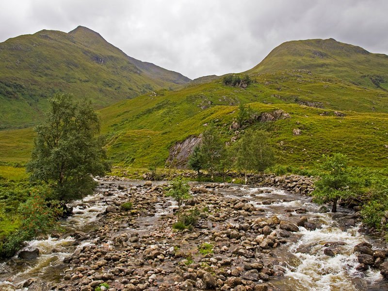
A small stream along Glen Shiel.
Hill Walking in the Cullins of Skye
The weather was so bad in Cullin hills of Skye that we have no pictures of our hill walking there. Cloud level was never higher than 300 meters. Many times mists swirled at ground level. We had less than 30 meter visibility on the ridges and navigated exclusively by GPS to summits and back down. Our most difficult climb was Sgurr nan Gillean 964 m (3162 ft) with hard rain and complete white out. We saw nobody on route from the time we left the Sligachan Inn.
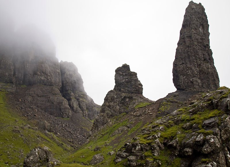
The Storr on Skye – Trotternish Peninsula
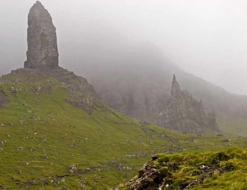
We arrived at the Storr late in the day. As the pinnacles came into view a storm blew in and all the walkers scurried away. We were left alone to enjoy a wet, misty and very windy Sanctuary and Old Man of Storr. You can just make out Richard (purple blip), Judith (yellow blip) and Alison (yellow blip) above the small outcrop in the right foreground.
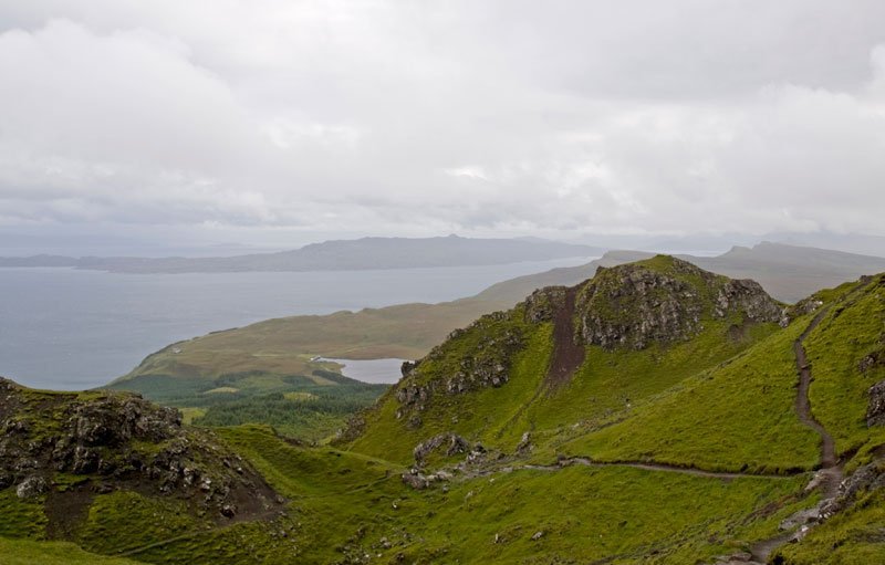
Walking down from the Sanctuary — The Inner Sound and Isle of Raasay in the distance.
The Quiraing – Trotternish Peninsula
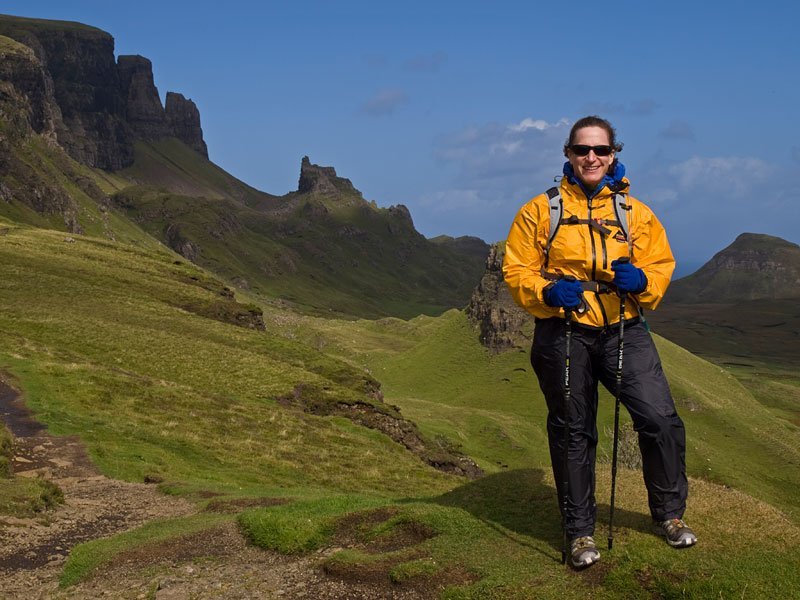
The Quiraing 543 m (2385 ft), a huge landslip on the Trotternish Peninsula. “The prison” is in the middle background. We were fortunate with mostly clear but blustery weather.
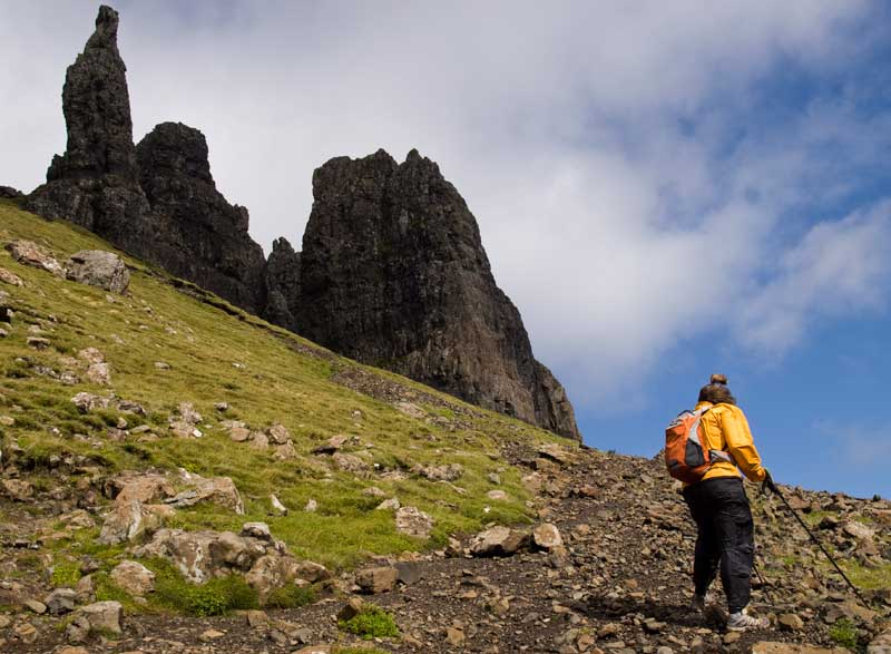
Struggling to stay upright in a stiff wind.
If you look hard across the Sound of Raasay you can see Wester Ross and the hills of Torridon, our next hill walking destination.
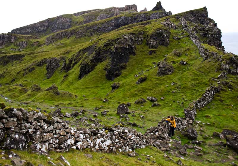
A stone crofters fence extending to cliffs edge.
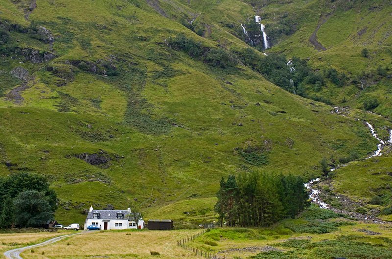
Wester Ross – Torridon Hills and Shiedaig
Wester Ross was our favorite walking area. Wilder and less populated than Glencoe or Skye, it has impressive glens and summits in every direction. Liathach, Beinn Eigh, Beinn Alligin, and Beinn Dearg are just a few famous mountains. It would take months and months of hill walking to do Wester Ross justice. Sheildaig is a lovely little town and home of our favorite B&B on the trip, the Aurora.
Looking north from the base of Beinn Eigh. This impressive horizontal line of clouds covered all Munroe summits for the day.
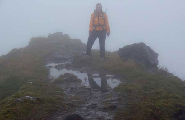
Alison on the Horns of Alligin in Torridon. These were typical Munroe conditions in Wester Ross.
Like the Cuillin Hills we had rain and less than 30 meter visibility on the ridges. We navigated
exclusively by GPS to summits and back down. [Picture taken with Olympus Stylus 830 camera.]
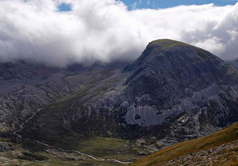
A small side summit of Beinn Eigh breaks out of the clouds. The main summit ridge of the mountain is in the background and completely enveloped in clouds.
On the top of the Applecross Peninsula en route to Loch Torridon and Sheildaig. [Photo, Richard]
The Gang
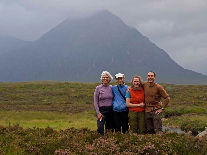
Judith, Richard, Alison and Alan on Rannoch Moor as dusk settles in. Stob Dearg, the highest peak of Buachaille Etive Mòr,
rises in the background.
Leave a Reply
Want to join the discussion?Feel free to contribute!